The easy Oltradige via ferrata on the Monte Roen leads to one of the most impressive viewpoints in South Tyrol
Image gallery: Via Ferrata Monte Roen


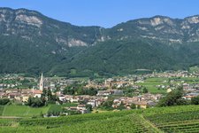
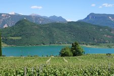
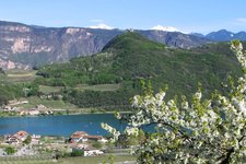
Between the Dolomites and the Brenta Group, high above the Oltradige area with Appiano and Caldaro, towers the Monte Roen. The mountain, near the Mendola Pass, is popular with hikers as a destination for sunrise tours. Its summit plateau can also be easily reached by mountain bike, and it is a worthwhile destination for via ferrata climbers. You start this adventure, which is classified as an easy via ferrata, from the Oltradige al Roen Mountain Hut.
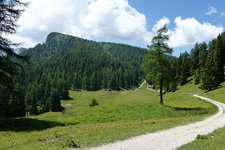
The approach is the hike to the Oltradige al Roen Hut. The path to the start of the route branches off right by the hut. On the eastern side of the Monte Roen, the via ferrata leads up to the summit ridge - the route mostly runs along ramps, ledges, and in gullies. The crux is a short, steeper section in the middle part. Once you reach the summit, you can enjoy the view over the Oltradige, Lake Caldaro, and the Bolzano basin - a feeling of freedom.
Afterwards, path no. 500 leads back down. A complete via ferrata kit, including a helmet, is required. You should avoid the route in wet and cold conditions, as both the via ferrata and the descent via the Gamssteig (path no. 500) become significantly more demanding. The best time to do the via ferrata is during the warm months from April to October. The actual climbing time is about 45 minutes, but you should allow a good four hours for the entire circular tour.
Author: AM
Experienced: September 2025
-
- Starting point:
- Monte Roen parking space
-
- Overall time:
- 04:15 h
-
- Total route length:
- 13,7 km
-
- Altitude:
- from 1.374 m to 2.116 m
-
- Altitude difference (uphill | downhill):
- +997 m | -997 m
-
- Signposts:
- 500, via ferrata
-
- Destination:
- top of the Monte Roen (2,116 m a.s.l.)
-
- Resting points:
- Oltradige Mountain Hut
-
- Recommended time of year:
- Jan Feb Mar Apr May Jun Jul Aug Sep Oct Nov Dec
-
- Download GPX track:
- Via Ferrata Monte Roen
-
- More information:
- only via ferrata approx. 45 minutes, whole route approx. 4 hours - the track shown on the map starts at the Monte Roen parking space near the chairlift
If you want to do this tour, we suggest you to check the weather and trail conditions in advance and on site before setting out.